Menu

  • Home
  • About
    • Who We Are
    • Approach
    • Awards / Publications
    • Staff
  • Projects
    • Residential
    • Public
    • MAW Lab
  • Services
    • Architecture
      • Our Process
      • Menu of Services
      • Fees
    • Design Build
  • News
  • Contact
Close Menu

  • Home
  • About
    • Who We Are
    • Approach
    • Awards / Publications
    • Staff
  • Projects
    • Residential
    • Public
    • MAW Lab
  • Services
    • Architecture
    • Design Build
  • News
  • Contact
  • Facebook
  • Instagram
  • Vimeo
Open Menu
  • Monteyne Architecture | Projects - Triple Decker Bridge

  • Monteyne Architecture | Projects - Triple Decker Bridge

  • Monteyne Architecture | Projects - Triple Decker Bridge

  • Monteyne Architecture | Projects - Triple Decker Bridge

  • Monteyne Architecture | Projects - Triple Decker Bridge

  • Monteyne Architecture | Projects - Triple Decker Bridge

  • Monteyne Architecture | Projects - Triple Decker Bridge

  • Monteyne Architecture | Projects - Triple Decker Bridge

  • Monteyne Architecture | Projects - Triple Decker Bridge

  • Monteyne Architecture | Projects - Triple Decker Bridge

  • Monteyne Architecture | Projects - Triple Decker Bridge

  • Monteyne Architecture | Projects - Triple Decker Bridge

Return to Top

<>

Triple Decker Bridge

Location: Omand's Creek, Wolseley Winnipeg, MB 
In conjunction with Storefront MB & the Winnipeg Free Press' RiverCity 2050 project


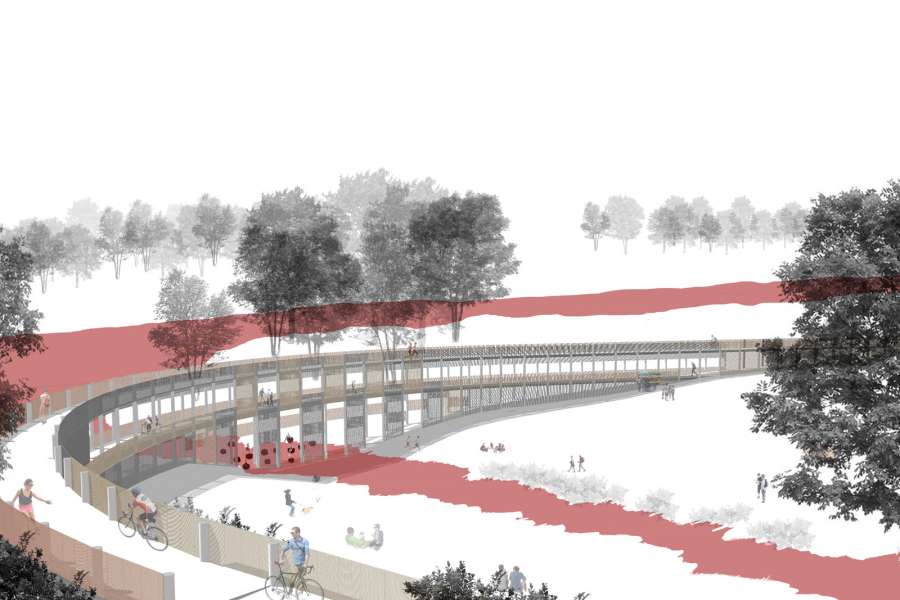
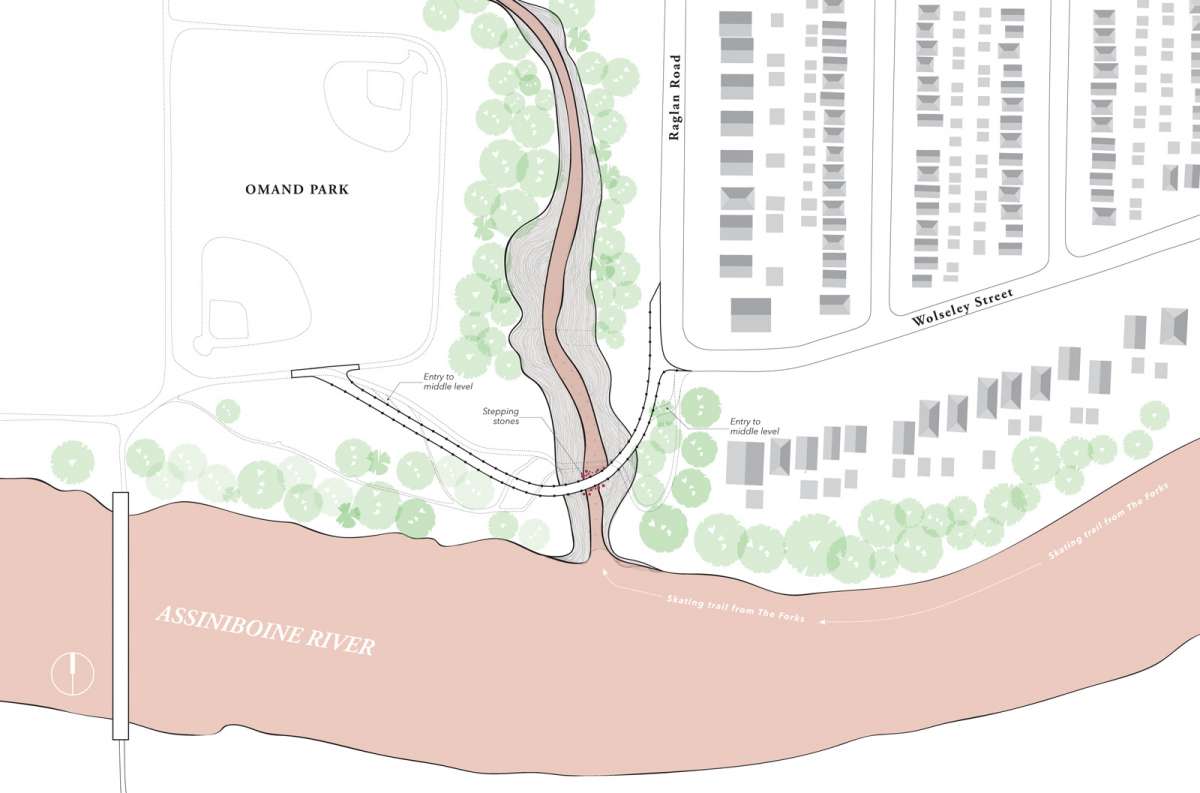
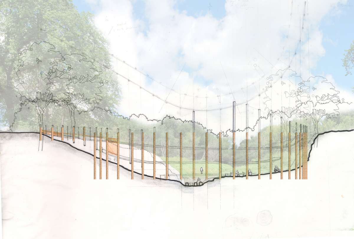
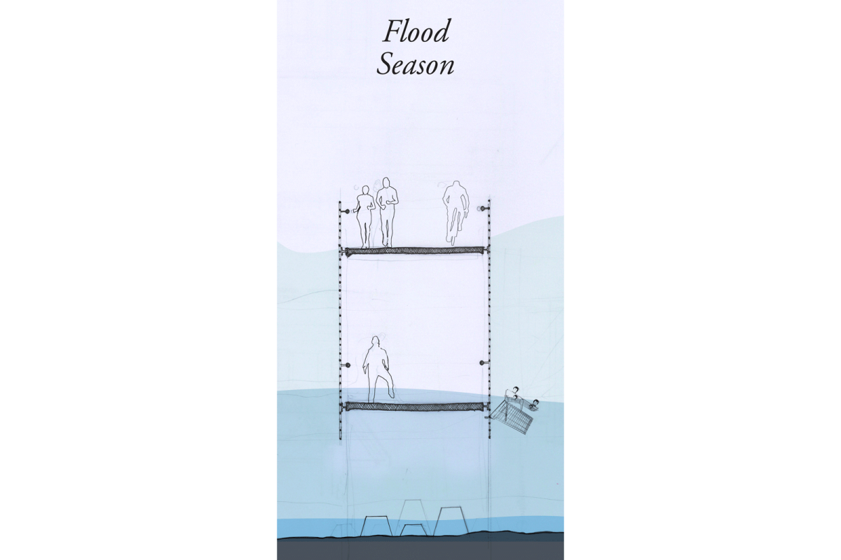
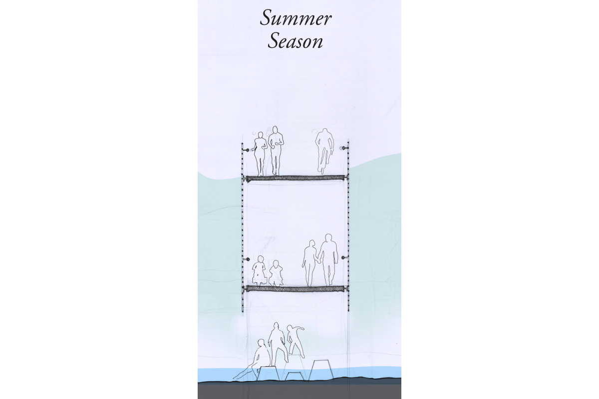
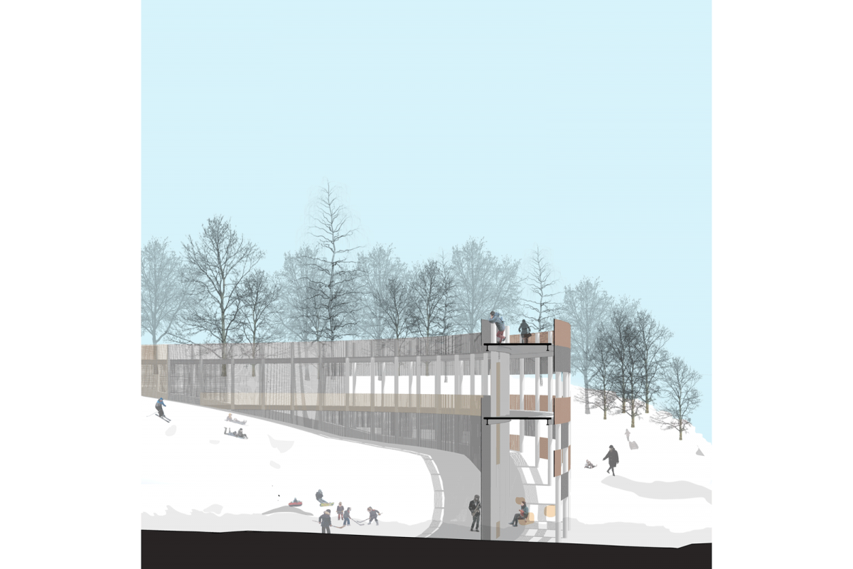
A three level bridge is proposed to cross the valley where Omand’s Creek meets the Assiniboine River. The goal is to both enhance active transportation linkages, and to enhance an established recreational zone with a structure that allows a range of experiences and interpretations of the river and creek landscape. Through careful positioning of the triple decker bridge on the site, four season recreational opportunities are made possible. Three distinctly different levels allow the bridge to operate in a multitude of conditions of high/low water.


The three levels:
1. The upper level is the level of the city. At this level, the bridge becomes a link in the active transportation network that runs along both sides of the Assiniboine River. The curved shape creates the opportunity for panoramic views of the river and creek landscape to be experienced as one commutes.

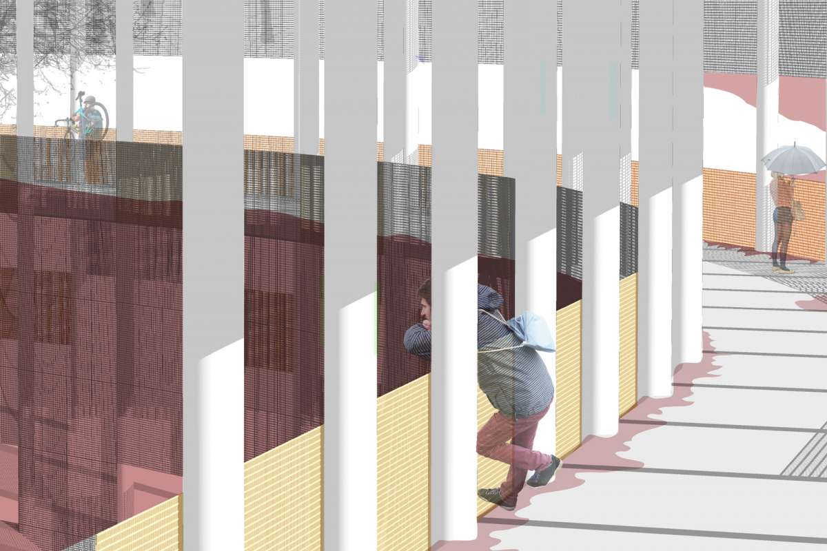
2. The middle level of the bridge is positioned 150mm above the level of the 100 year flood. Being on this level during a spring-time flood will be exciting and a bit scary. Protective steel mesh will encase the pedestrian space. The mesh will also act as a filter that catches the trash carried downstream during high water events. This level is weather protected with the upper level acting as roof.

3. The lowest bridge level is based on the normal summer water level. At this point, the bridge is reduced to large stepping stones across a narrow and shallow channel, allowing direct contact with the water.
Inspirational precedents: ancient Roman aqueducts, wooden trestle railway bridges, and the Luminous Veil on the Bloor Street Viaduct in Toronto.

  • Home
  • About
    • Who We Are
    • Approach
    • Awards / Publications
    • Staff
  • Projects
    • Residential
    • Public
    • MAW Lab
  • Services
    • Architecture
    • Design Build
  • News
    • Victoria Beach Cabin featured on...
    • WAG Home Tour Goes to the Beach !
    • Journal of commerce covers our...
  • Contact

Bobsled Projects Inc.
204.943.1536
info@bob-sled.ca
194 Sherbrook Street
Winnipeg, Manitoba
Canada R3C 2B6

Copyright 2021 Bobsled Projects Inc.